

Select NOAA-NWS Forecast Office Text Products
(Product availability varies with seasons, forecast office, and weather.)
Forecast Discussion for Boise, ID
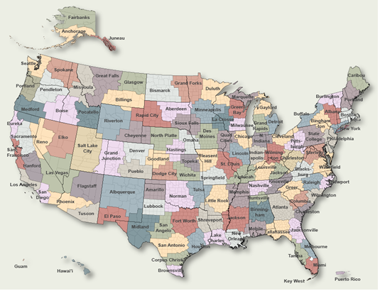
To Select Another NWS Office Click on Map or Choose from List
|
| Select Forecast Office: | Select Product: |
447 FXUS65 KBOI 091536 AFDBOI Area Forecast Discussion National Weather Service Boise ID 936 AM MDT Thu May 9 2024 .DISCUSSION...Weak northeasterly flow across southwest Idaho today will produce scattered CU. There is enough weak instability and moisture for isolated showers and thunderstorms across the Western Magic Valley and Southern Twin Falls County. A couple of high-res models this morning are showing showers across the Boise Mountains and eastern Upper Treasure Valley though confidence is low at this time. Temperatures are expected to reach near normal today. No updates needed at this time. && .AVIATION...VFR. Generally clear, except afternoon cloud build-ups over south-central Idaho and some mid/high clouds over higher terrain of central Idaho. Low chance (25%) of light showers at KTWF/KJER after 21Z. Sfc winds: NW 10-15 kt with gusts to 20 kt, except becoming E 15-10kt with gusts to 25kt for KJER/KTWF. Winds at 10k ft MSL: NE 10-25 kt by 09/00Z. KBOI...VFR. Sfc winds: Variable less than 5kt become WNW 10-15kt after 18Z. Weekend Outlook...Mostly clear skies through the weekend with light winds. && .PREV DISCUSSION... SHORT TERM...Today through Saturday night...An upper level ridge to our northwest combined with a trough to our southeast will give us NE flow aloft through Saturday. It will also give most of us mostly clear skies and warmer temperatures. And while they will also be warming up, the western Magic Valley and points south will see a chance of showers and a slight chance of weak thunderstorms this afternoon into the early evening. Friday will be dry with temperatures around 5 degrees above normal. Late Saturday, as the ridge axis weakens and moves overhead, we will have light NW winds aloft. Temperatures will rise to around 10 degrees above normal by Saturday. LONG TERM...Sunday through Thursday...After our upper flow shifts to out of the NW late Saturday, a weak trough will move over the region late Sunday night or Monday. This should bring increased clouds, but most likely little to no precipitation. Ensembles indicate this will likely be followed by a return to NW flow aloft as a new ridge builds along the coast. The latest GFS is an outlier with its depiction of a trough moving into the area next Thursday. For now, this solution has been noted but not included in the forecast. Temps in the long term will be above normal, with Sunday the most likely to be the warmest at 10-15 degrees above normal. There is high chance (70-99%) of temps above 80 degrees from Ada County northwest through the lower Treasure Valley Saturday, then a near 100% chance Sunday. This high chance extends throughout the upper Treasure Valley and into the western Magic Valley Sunday. && .BOI WATCHES/WARNINGS/ADVISORIES... ID...None. OR...None. && $$ www.weather.gov/Boise Interact with us via social media: www.facebook.com/NWSBoise www.twitter.com/NWSBoise DISCUSSION...JDS AVIATION.....MC SHORT TERM...SP LONG TERM....SP |
Previous Forecast Discussions may be found at
NWS Boise, ID (BOI) Office Forecast Discussions.
(Click 'Previous Version' there to view past versions successively.
Some may differ only in time posted.)
Products Courtesy of NOAA-NWS
NWS Information Parsing Script by Ken True at Saratoga Weather - WFO and Products Scripts by SE Lincoln Weather.
Mapping by Curly at Michiana Weather and by Tom at My Mishawaka Weather.


